
�������: 1-15 ���鵽��֪ʶ�� ��ѧ laser����ؼ�¼1089�� . ��ѯʱ��(0.125 ��)
VIRTUALISING AN OTTOMAN FORTRESS �C LASER SCANNING AND 3D MODELLING FOR THE DEVELOPMENT OF AN INTERACTIVE, IMMERSIVE VIRTUAL REALITY APPLICATION
3D HTC Vive modelling reconstruction virtual reality
2019/3/4
��A picture is worth a thousand words��: a famous quote about knowledge dissemination but also literally true. The documentation of cultural heritage (CH) monuments is carried out by measurements and ph...
THE SUITABILITY OF TERRESTRIAL LASER SCANNING FOR BUILDING SURVEY AND MAPPING APPLICATIONS
Terrestrial Laser Scanning Handheld Mobile Laser Scanning Building Survey Mapping
2019/3/4
The popularity of Terrestrial Laser Scanner (TLS) has been introduced into a field of surveying and has increased dramatically especially in producing the 3D model of the building. The used of terrest...
COMPARISON WITH ACCURACY OF TERRESTRIAL LASER SCANNER BY USING POINT CLOUD ALIGNED WITH SHAPE MATCHING AND BEST FITTING METHODS
laser scanning time of flight phase shift shape matching natural distributions Ostia
2019/3/4
Recently operation systems of laser scanning have been obviously improved; for instance shape matching has been equipped with software on a post processing stage so measurement without any targets is ...
TERRESTRIAL LASER SCANNER AND FAST CHARACTERIZATION OF SUPERFICIAL LESIONS IN ARCHITECTURAL DIAGNOSIS
errestrial laser scanner pathology defensive towers masonry Camarles Tower
2019/3/1
The development of massive data captures techniques (MDC) in recent years, such as the Terrestrial Laser Scanner (TLS), raises the possibility of developing new assessment procedures for architectural...
FORENSIC ENGINEERING SURVEYS WITH UAV PHOTOGRAMMETRY AND LASER SCANNING TECHNIQUES
UAV Photogrammetry Terrestrial Laser Scanning
2019/3/1
This work aims at presenting the use of new technologies in the field of forensic engineering. In particular, the use of UAV photogrammetry and laser scanning is compared with the traditional methods ...
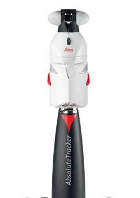
�������ƣ����������Laser Tracker Leica TN90����Ҫ���ܣ�1�����ⶨλ���� 2���ռ������� 3���ռ�λ�öȲ�����
THE SUITABILITY OF TERRESTRIAL LASER SCANNING FOR STRATA BUILDING
Terrestrial Laser Scanning Strata building
2018/11/8
During the recent years, the used of terrestrial laser scanning (TLS) is becoming rapidly popular because of its ability in several applications, especially the ability to observe complex documentatio...
EVALUATING THE PERFORMANCE OF TERRESTRIAL LASER SCANNING FOR LANDSLIDE MONITORING
landslide monitoring terrestrial laser scanning scanning resolutions geodetic method deviation maps
2018/11/8
Nowadays, Terrestrial Laser Scanning (TLS) technology is gaining popularity in monitoring and predicting the movement of landslide due to the capability of high-speed data capture without requiring a ...
COMPARING THE PERFORMANCE OF POINT CLOUD REGISTRATION METHODS FOR LANDSLIDE MONITORING USING MOBILE LASER SCANNING DATA
point clouds, registration methods landslide monitoring mobile laser scanning deviation maps
2018/11/8
The aim of the research is to evaluate the performance of the point cloud registration methods using mobile laser scanning data. The point cloud registration methods involved in this research are matc...
IMAGE-BASED METHOD FOR THE PAIRWISE REGISTRATION OF MOBILE LASER SCANNING POINT CLOUDS
pairwise registration relative registration image registration template matching
2018/11/9
In this paper, a method is proposed for solving relative translations of 3D point clouds collected by Mobile Laser Scanning (MLS) techniques. The proposed approach uses the attributes of the 3D points...
RESEARCH ON COORDINATE TRANSFORMATION METHOD OF GB-SAR IMAGE SUPPORTED BY 3D LASER SCANNING TECHNOLOGY
GB-SAR Interference measurement 3D laser scanning Coordinate Transformation
2018/5/15
In the image plane of GB-SAR, identification of deformation distribution is usually carried out by artificial interpretation. This method requires analysts to have adequate experience of radar imaging...
REFINED SIMULATION OF SATELLITE LASER ALTIMETER FULL ECHO WAVEFORM
Satellite laser altimetry Waveform simulation ICESat/GLAS GF-7 satellite LPA
2018/5/15
The return waveform of satellite laser altimeter plays vital role in the satellite parameters designation, data processing and application. In this paper, a method of refined full waveform simulation ...
OPTIMAL INFORMATION EXTRACTION OF LASER SCANNING DATASET BY SCALE-ADAPTIVE REDUCTION
Multi-scale Surface variation Radial basis function Just-Noticeable-Difference Degradation
2018/5/16
3D laser technology is widely used to collocate the surface information of object. For various applications, we need to extract a good perceptual quality point cloud from the scanned points. To solve ...
WATER LEAKAGE DIAGNOSIS IN METRO TUNNELS BY INTERGRATION OF LASER POINT CLOUD AND INFRARED THERMAL IMAGING
Tunnel Infrared Thermal Imaging Laser Scanning Intensity Data Water Leakage Diagnosis
2018/5/16
Diagnosis of water leakage in metro tunnels is of great significance to the metro tunnel construction and the safety of metro operation. A method that integrates laser scanning and infrared thermal im...
JOINT CALIBRATION OF 3D LASER SCANNER AND DIGITAL CAMERA BASED ON DLT ALGORITHM
Direct Linear Transformation 3D laser scanner Digital camera Point-cloud Image
2018/5/14
Design a calibration target that can be scanned by 3D laser scanner while shot by digital camera, achieving point cloud and photos of a same target. A method to joint calibrate 3D laser scanner and di...
�й��о����������а�-��
- ���ڼ���...
�й�ѧ���ڿ����а�-��
- ���ڼ���...
�����ѧ���л������а�-��
- ���ڼ���...
�й���ѧ���а�-��
- ���ڼ���...
�ˡ���-ƪ
- ���ڼ���...
�Ρ���-ƪ
- ���ڼ���...
��������-ƪ
- ���ڼ���...
�������� -ƪ
- ���ڼ���...
֪ʶҪ��-ƪ
- ���ڼ���...
���ʶ�̬-ƪ
- ���ڼ���...
��������-ƪ
- ���ڼ���...
ѧ��ָ��-ƪ
- ���ڼ���...
ѧ��վ��-ƪ
- ���ڼ���...