搜索结果: 1-11 共查到“农学 satellite data”相关记录11条 . 查询时间(0.098 秒)

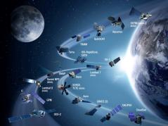
Harnessing rich satellite data to estimate crop yield(图)
Harnessing rich satellite data estimate crop yield
2017/9/5
Without advanced sensing technology, humans see only a small portion of the entire electromagnetic spectrum. Satellites see the full range—from high-energy gamma rays, to visible, infrared, and low-en...
MONITORING SPATIAL AND STRUCTURAL CHANGES OF FOREST COVER IN YENICIFTLIK WATERSHED WITH MULTITEMPORAL SATELLITE DATA
Remote Sensing Monitoring Forest Resources Natural Resources Planning Change Detection Landsat
2015/7/29
Recent surveys indicate that changes in forest cover and land use have a direct and enormous effect on wildlife, water quality, climate
and carbon cycling. The forest ecosystem is threatened constan...
Assessment of some forest characteristics employing IKONOS satellite data
texture categorial knowledge vegetation cover
2015/3/6
In recent years, satellite remote sensing has become a new tool for estimation of forest condition. The paper deals with spruce timber growing stock and vegetation cover assessment employing IKONOS sa...
Object-oriented classification of Ikonos satellite data for the identification of tree species composition
automated image analysis eCognition median filters
2015/3/3
This paper describes the automated classification of tree species composition from Ikonos 4-meter imagery using an object-oriented approach. The image was acquired over a man-planted forest area with ...
Creating of digital surface model and orthophoto from ASTER satellite data and their application in land/water research
remote sensing ASTER digital surface model orthophoto
2015/2/4
Satellite data has become a commonly used information source. Landscapes components such as water, inorganic substances, vegetation, and the atmosphere may be distinguished making use of their spectra...
Characteristics of Band and Luminance and Classification of the Tree Vigor of Aged, Large-diameter Japanese Red Pine (Pinus densiflora) Using High-resolution IKONOS Satellite Data
IKONOS Japanese red pine remote sensing tree vigor
2009/8/27
The relationships between characteristics of band and luminance and classification of the tree vigor of aged, large-diameter Japanese Red Pine was performed using high-resolution IKONOS satellite data...
Uses of High Spatial Resolution Satellite Data to Forest Monitoring
extraction of single tree forest damage high resolution satellite data object-oriented classification
2009/8/21
This paper describes the characteristics of high resolution satellite data, methods to observe single trees and forest stands using it, and the results of previous studies. It also introduces its appl...
Satellite Data Use to Vegetable—It Centers on the Topic of the Examination that Understands the Lettuce Transplant Area—
Examination Understands Lettuce Transplant Vegetable
2009/7/10
Satellite Data Use to Vegetable—It Centers on the Topic of the Examination that Understands the Lettuce Transplant Area—
Energy Budget Over Semi-Arid Agro-Ecosystem Using Satellite Data
Wheat Semi-arid ET NDVI LAS MODIS
2016/4/8
Energy-water-carbon cycle is the central theme of biosphere-atmosphere interaction to understand the response and feedback processes in a climate system. The crop response in a semi-arid climate is fr...
Determination of Land Distribution and Spectral Characteristics of the Wheat Crop Grown in The West Mediterranean Region by Using Digital Satellite Data
Land Distribution Spectral Characteristics Wheat Crop Grown West Mediterranean Region Digital Satellite Data
2009/1/15
The aim of this study was to determine the spectral characteristics and distribution of the wheat growing areas in West Mediterranean Region by means of the digital data from the Landsat-5 Thematic M...
Studies of soil temperature on the basis of satellite data
remote sensing brightness temperature thermal image satellite image
2008/11/12
Thermal properties of soils can be investigated from satellite level, using a number of satellite systems (a.o. LANDSAT ETM+, ASTER/TERRA). Studies conducted in this work were aimed at searching for r...

