
�������: 1-14 ���鵽������ѧ���� Greenland����ؼ�¼14�� . ��ѯʱ��(0.109 ��)
MASS BALANCE CHANGES AND ICE DYNAMICS OF GREENLAND AND ANTARCTIC ICE SHEETS FROM LASER ALTIMETRY
Laser Atimetry Surface Elevation Changes Greenland Antarctica Ice Sheet Mass Balance Sea-Level Rise
2016/11/30
During the past few decades the Greenland and Antarctic ice sheets have lost ice at accelerating rates, caused by increasing surface temperature. The melting of the two big ice sheets has a big impact...
IDENTIFICATION OF A ROBUST LICHEN INDEX FOR THE DECONVOLUTION OF LICHEN AND ROCK MIXTURES USING PATTERN SEARCH ALGORITHM (CASE STUDY:GREENLAND)
Hyperspectral Remote Sensing Mineral Exploration Geological Mapping Spectral Mixture Analysis Spectrometry Lichen
2016/11/24
Lichens are the dominant autotrophs of polar and subpolar ecosystems commonly encrust the rock outcrops. Spectral mixing of lichens and bare rock can shift diagnostic spectral features of materials of...
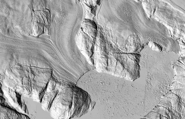
EXTRACTION OF ICE SHEET LAYERS FROM TWO INTERSECTED RADAR ECHOGRAMS NEAR NEEM ICE CORE IN GREENLAND
Cryosphere Ice sheet layering Radar echo sounding Sub-glacial ice flow NASA IceBridge
2016/11/23
Accumulation of snow and ice over time result in ice sheet layers. These can be remotely sensed where there is a contrast in electromagnetic properties, which reflect variations of the ice density, ac...
USING REMOTE SENSING AND RPAS FOR ARCHAEOLOGY AND MONITORING IN WESTERN GREENLAND
Aerial Photogrammetry RPAS Glaciology InSAR Greenland
2016/7/5
Since 2002, German low-cost scientific expeditions to Greenland have been performed. The objective was a geodetic survey and glaciology with GNSS technology �C mainly the measurement of glacier profile...
DETERMINATION OF SPATIO-TEMPORAL VELOCITY FIELDS ON GLACIERS IN WEST-GREENLAND BY TERRESTRIAL IMAGE SEQUENCE ANALYSIS
Glaciology Motion analysis Image sequences
2015/12/29
Some glaciers in Greenland are currently showing dramatic changes: A fast retreat of the glacier front, thinning and acceleration of glacier movement. As a prominent example, Jacobshavn Isbræ glacier ...
Geometrical Transformation of Nautical Charts in Greenland
Nautical Charts Transformation Kriging
2015/12/16
We present an algorithm for transformation and reconstruction of nautical charts, based on identification of common points in new orthophotos and old charts. The algorithm shows to be implementa...
Analysis exposes faster disintegration of major Greenland glacier
faster disintegration Greenland glacier
2015/12/7
A study appearing in Science magazine today shows a vast ice sheet in northeast Greenland has begun a phase of speeded-up ice loss, contributing to destabilization that will cause global sea-level ris...
Analysis of the motion behaviour of Jacobshaven isbræ glacier in Greenland by monocular image sequence analysis
Motion analysis image sequences glaciology
2015/8/24
Jakobshavn Isbræ on the west coast of Greenland is one of the fastest and most productive glaciers in the world. It has been moving with an average velocity of 20 meters per day over a long time,...
LASER MONITORING OF ICE ELEVATIONS AND SEA-ICE THICKNESS IN GREENLAND
Laser altimetry laser scanning SAR interferometry glaciers sea-ice
2015/3/10
A low-cost Twin-Otter based laser altimetry and scanning system have been set up by KMS in several different commercial aircraft, and flown extensively in connection with airborne gravity activities i...
STUDYING AND MONITORING THE GREENLAND ICE SHEET USING GIS TECHNIQUES
GIS Remote Sensing Mass Balance Accumulation Rate Global Warming Laser Altimetry Subglacial Topography DEM
2015/2/3
Glaciers and ice sheets are the most important hydrological resources on Earth and play an important role in the global
climate system. The Greenland Ice Sheet stores 9 % of the Earth��s fresh water s...
The highest-resolution satellite images ever taken of that region are making their debut. And while each individual pixel represents only one moment in time, taken together they show the ice sheet as ...
STEREO DERIVED CLOUD TOP HEIGHT CLIMATOLOGY OVER GREENLAND FROM 20 YEARS OF THE ALONG TRACK SCANNING RADIOMETER (ATSR) INSTRUMENTS
Climate Environment Atmosphere Imagery Matching Pattern Stereoscopic
2014/4/29
Current algorithms for the determination of cloud top height and cloud fraction in Polar Regions tend to provide unreliable results, particularly in the presence of isothermal conditions within the at...
TOWARDS INTRODUCING A GEOCODING INFORMATION SYSTEM FOR GREENLAND
Online GIS Services, Spatial data infrastructure, Greenland addressing system
2014/5/8
Currently, addressing practices in Greenland do not support geocoding. Addressing points on a map by geographic coordinates is vital
for emergency services such as police and ambulance for avoiding a...
Different Melt Regimes Indicated by Surface Albedo Measurements at the Greenland Ice Sheet Margin �C Application of TM Image
Different Melt Regimes Indicated Surface Albedo Measurements at the Greenland Ice Sheet Margin Application of TM Image
2014/4/15
Different Melt Regimes Indicated by Surface Albedo Measurements at the Greenland Ice Sheet Margin �C Application of TM Image.
�й��о����������а�-��
- ���ڼ���...
�й�ѧ���ڿ����а�-��
- ���ڼ���...
�����ѧ���л������а�-��
- ���ڼ���...
�й���ѧ���а�-��
- ���ڼ���...
�ˡ���-ƪ
- ���ڼ���...
�Ρ���-ƪ
- ���ڼ���...
��������-ƪ
- ���ڼ���...
�������� -ƪ
- ���ڼ���...
֪ʶҪ��-ƪ
- ���ڼ���...
���ʶ�̬-ƪ
- ���ڼ���...
��������-ƪ
- ���ڼ���...
ѧ��ָ��-ƪ
- ���ڼ���...
ѧ��վ��-ƪ
- ���ڼ���...