
�������: 1-15 ���鵽����ѧ Land����ؼ�¼589�� . ��ѯʱ��(0.113 ��)
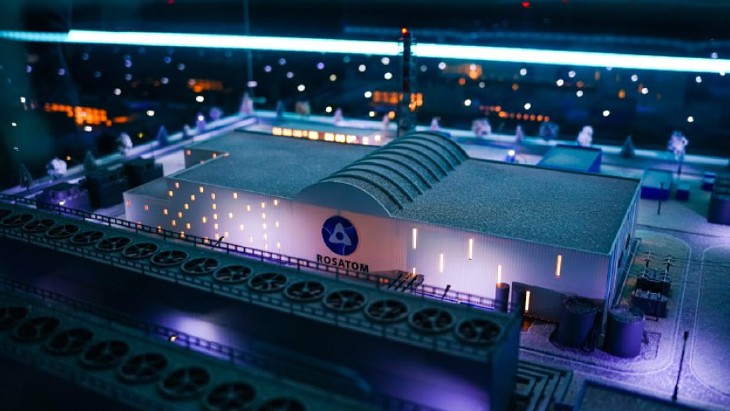
Nuclear regulator Rostekhnadzor has granted a licence to build the country's first land-based small modular reactor (SMR), in the Republic of Sakha (also known as Yakutia) in Russia's Arctic north.

Researchers create the first artificial vision system for both land and water��ͼ��
�˹��Ӿ�ϵͳ ����з�� ȫ����Ұ �ϳ��Ӿ�ϵͳ
2023/6/20
Giving our hardware sight has empowered a host of applications in self-driving cars, object detection, and crop monitoring. But unlike animals, synthetic vision systems can��t simply evolve under natur...
�й����ʴ�ѧ��ѧ������չԺ��ΰ�� �ȣ������ѧԺ. Remote Sensing��2019��, Fine Land Cover Classification in an Open Pit Mining Area Using Optimized Support Vector Machine and WorldView-3 Imagery
���ʻ�����ң�У����ܣ����룻�о�����
2021/10/15
���գ��й����ʴ�ѧ�����ѧԺ��ΰ�θ������Ŷ��ٴ��ڵ��ʻ���ң�����ܽ����о�����ȡ����Ҫ��չ������о��ɹ������ڹ��������ڿ���Remote Sensing����2018��Ӱ������Ϊ4.118�������ĵ�һ����Ϊ��ΰ�θ����ڣ�ͨѶ����Ϊ���Ծ����ڡ�

�й���ѧԺ������ѧ����Դ�о���ʷ�Ľ��ȹ��ڡ��߱�ũ���ۺ�Ч�����ۼ���ռ�Ԥ�⡱�Ŀ��гɹ���ũ�ֿ�ѧһ��TOP�ڿ���Land Degradation & Development����Ϊ�������·�����ͼ��
ʷ�Ľ� �߱� ũ���ۺ�Ч������ �ռ�Ԥ�� ���гɹ�
2020/8/24
����߱�ũ���ǹ��̺������ʳ�������������Ϲ�����ʳ��ȫ�Ĺؼ��ٴ롣���������ҹ������ƽ��߱�ũ�ィ�裬ȡ�������Գ�Ч����ˣ���չ�߱�ũ���ۺ�Ч�����ۼ���ռ�߶�Ԥ���о����ܹ�Ϊ�ҹ�δ���߱�ũ�ィ�貼�֡��Ż�������ս�Ծ����ṩ��ѧ���ݺ�֧�š����ڣ�ʷ�Ľ������ҹ���Ҫ����ʳ������֮һ�ƻ�����Ϊ�о��������˰������á���ᡢ��̬Ч����ۺ�Ч������ָ����ϵ���ۺ�����ģ�ͣ��Իƻ������߱�ũ�������...
�й���ѧԺ�½���̬������о���Ӣ���ڿ�Journal of Arid Land 2019��SCIӰ��������������
�й���ѧԺ�½���̬������о��� Ӣ���ڿ� Journal of Arid Land 2019�� SCIӰ������
2020/7/30
2020��6��29�գ����Ψ��������2019��SCI�ڿ���֤���� (Journal Citation Reports, JCR)���й���ѧԺ�½���̬������о��������Ӣ���ڿ�����Journal of Arid Land (JAL) 2019��Ӱ�����Ӵ���ʷ�¸ߣ��ﵽ1.899����ȥ������40%�����ڿ�λ�ӻ�����ѧѧ�ƣ�Environmental Sciences��Q3�������½�ĿǰΨһ��SCI�ڿ�...
A COMPARATIVE STUDY OF LAND SURFACE TEMPERATURE WITH DIFFERENT INDICES ON HETEROGENEOUS LAND COVER USING LANDSAT 8 DATA
LST Landsat 8 NDBI NDSI NDVI NDWI Land Cover
2019/2/27
The temperature rise in urban areas has become a major environmental concern. Hence, the study of Land surface temperature (LST) in urban areas is important to understand the behaviour of different la...
MODEL FOR LAND COVER ESTIMATION USING UNSUPERVISED MACHINE LEARNING ON GOOGLE MAPS COLOR IMAGES
Unsupervised learning algorithms CORINE nomenclature Google Static Maps API k-means clustering
2019/2/27
Remote sensing data and satellite images are broadly used for land cover information. There are so many challenges to classify pixels on the basis of features and characteristics. Generally it is pixe...
IDENTIFICATION OF LOW ACCURACY REGIONS IN LAND COVER MAPS USING UNCERTAINTY MEASURES AND CLASSIFICATION CONFIDENCE
Multispectral images Classification Uncertainty Confidence Accuracy Spatial variation
2018/11/9
The aim of this article is to assess if the data provided by soft classifiers and uncertainty measures can be used to identify regions with different levels of accuracy in a classified image. To this ...
OPEN SOURCE SOFTWARE AND OPEN EDUCATIONAL MATERIAL ON LAND COVER MAPS INTERCOMPARISON AND VALIDATION
Capacity Building Education Land Cover Open Access Open Source Validation
2018/11/9
Land Cover (LC) maps represent key resources to understand, model and address many global and local dynamics affecting our planet. They are usually derived from the classification of satellite imagery...
LAND USE CLASSIFICATION FROM COMBINED USE OF REMOTE SENSING AND SOCIAL SENSING DATA
Human Behavior Social Sensing Remote Sensing Decision Tree Geographic Information System Accuracy Assessment
2018/11/9
Large amounts of data can be sensed and analyzed to discover patterns of human behavior in cities for the benefit of urban authorities and citizens, especially in the areas of traffic forecasting, urb...
THE APPLICATION OF CHINESE HIGH-SPATIAL-RESOLUTION REMOTE SENSING SATELLITE IMAGE IN LAND LAW ENFORCEMENT INFORMATION EXTRACTION
land use high resolution batch process geoprocessing model information extraction mapping
2018/5/15
Chinese high -resolution (HR) remote sensing satellites have made huge leap in the past decade. Commercial satellite datasets, such as GF-1, GF-2 and ZY-3 images, the panchromatic images (PAN) resolut...
DYNAMIC MONITORING OF LAND COVER IN DONGTING LAKE AREA BETWEEN 1995�C2015 WITH LANDSAT IMAGERY
Dongting Lake, Land Cover, Remote Sensing, Classification, Transfer Matrix, Landscape Pattern
2018/5/15
In this paper, the Landsat imagery of 1995, 2006 and 2015 is used to monitor land cover change in Dongting Lake area. Our study mainly focuses on five types of land cover: water body, wetland, built-u...
ANALYSIS OF LAND SUBSIDENCE MONITORING IN MINING AREA WITH TIME-SERIES INSAR TECHNOLOGY
Time-series InSAR Land Subsidence ALOS PALSAR RADARSAT-2
2018/5/15
Time-series InSAR technology has become a popular land subsidence monitoring method in recent years, because of its advantages such as high accuracy, wide area, low expenditure, intensive monitoring p...
OBJECT-BASED RANDOM FOREST CLASSIFICATION OF LAND COVER FROM REMOTELY SENSED IMAGERY FOR INDUSTRIAL AND MINING RECLAMATION
Reclamation Area Classification of Land Use Random Forest Grid-search Object-based Multi-resolution Segmentation Multi-feature Variables
2018/5/11
The RF method based on grid-search parameter optimization could achieve a classification accuracy of 88.16 % in the classification of images with multiple feature variables. This classification ...
STUDY ON REMOTE SENSING IMAGE CHARACTERISTICS OF ECOLOGICAL LAND: CASE STUDY OF ORIGINAL ECOLOGICAL LAND IN THE YELLOW RIVER DELTA
Ecological Land Remote Sensing Spectral Characteristics Yellow River Delta NDVI
2018/5/11
Takes the Yellow River Delta as an example, this paper studies the characteristics of remote sensing imagery with dominant ecological functional land use types, compares the advantages and disadvantag...
�й��о����������а�-��
- ���ڼ���...
�й�ѧ���ڿ����а�-��
- ���ڼ���...
�����ѧ���л������а�-��
- ���ڼ���...
�й���ѧ���а�-��
- ���ڼ���...
�ˡ���-ƪ
- ���ڼ���...
�Ρ���-ƪ
- ���ڼ���...
��������-ƪ
- ���ڼ���...
�������� -ƪ
- ���ڼ���...
֪ʶҪ��-ƪ
- ���ڼ���...
���ʶ�̬-ƪ
- ���ڼ���...
��������-ƪ
- ���ڼ���...
ѧ��ָ��-ƪ
- ���ڼ���...
ѧ��վ��-ƪ
- ���ڼ���...