搜索结果: 1-15 共查到“Environmental Impact”相关记录50条 . 查询时间(0.218 秒)
HOW CAN 3D GIS BE USED TO BETTER STORE, INTEGRATE AND COMMUNICATE RESULTS OF ENVIRONMENTAL IMPACT ASSESSMENTS?
3D GIS GIS environmental datasets Environmental Impact Assessment
2018/11/9
In the United Kingdom, the process of conducting the Environmental Impact Assessment (EIA) is a legal requirement for projects of considerable size or those that can affect the environment. EIA result...

Researchers Discover Higher Environmental Impact From Cookstove Emissions(图)
Researchers Higher Environmental Cookstove Emissions
2018/1/10
Cookstoves are a central part of millions of homes throughout Asia: families often use readily available and cheap biofuels — such as crop chaff or dung — to prepare the food needed to survive.Previou...

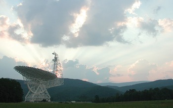
Green Bank Observatory:NSF Releases Draft Environmental Impact Statement(图)
Green Bank Observatory NSF Draft Environmental Impact
2017/12/19
On Nov. 8, 2017, the National Science Foundation (NSF) published the Draft Environmental Impact Statement (DEIS) for the Green Bank Observatory in Green Bank, West Virginia.NSF prepared the DEIS in co...
SCREENING OF ENVIRONMENTAL IMPACT OF POLLUTION WITH THE QGIS PLUGIN ENVIFATE
GIS Contamination modelling python QGIS environmenti
2017/8/10
Public and academic interest in environmental pollution caused by toxic substances and other sources, like noise, is constantly raising. To protect public health and ecosystems it is necessary to main...
USING SATELLITE DATA FOR ENVIRONMENTAL IMPACT ANALYSIS IN ECONOMIC GROWTH:THE CASE OF MONGOLIA
Satellite Data Environmental Impact Analysis Economic growth The Green Solow model The Ramsey- Cass- Koopmans model
2016/12/1
The Mongolian economy is based on the primary and secondary economic sectors of agriculture and industry. In addition, minerals and mining become a key sector of its economy. The main mining resources...
ENVIRONMENTAL IMPACT ASSESSMENT OF ROSIA JIU OPENCAST AREA USING AN INTEGRATED SAR ANALYSIS
Environment Rosia Jiu mining area DInSAR analysis multi-temporal SAR data TerraSAR-X Staring Spotlight Mode
2016/11/30
The satellite data provide a new perspective to analyse and interpret environmental impact assessment as function of topography and vegetation. The main goal of this paper is to investigate the new St...
ENVIRONMENTAL IMPACT ASSESSMENT OF MINING RELATED DEWATERING ACTIVITIES USING INTEGRATED INSAR,OPTICAL REMOTE SENSING AND PUMPING DATA
Interferometric SAR EIA Subsidence Dewatering Mining
2015/12/30
Open pit mining sometimes intercepts highly permeable zones, with resulting high inflows of water into the excavation area. This remains a major problem in the mining industry and requires constant mo...
MONITORING ENVIRONMENTAL IMPACT OF LAND USE: EVALUATING AN AGRICULTURAL AREA OF DISTRITO FEDERAL, BRAZIL
Agriculture Classification Land Use Monitoring Remote Sensing Sustainable Development
2015/8/31
The formation of the landscape in Distrito Federal (DF) is strongly linked to the densification processes of the urban mesh and of the
agricultural occupation growth, which can be considered the mai...
While aircraft environmental performance has been important since the beginnings
of commercial aviation, continuously increasing passenger traffic and a rise in public
awareness have made aircr...
The focus of the present study is to determine the feasibility of including noise and emissions
constraints in the early design of the aircraft and
mission. This paper introduces the design tool and...
Towards Improvement in Singapore's Transportation Efficiency and Environmental Impact
Performance Efficiency Performance Improvement Environmental Sustainability Transportation
2015/5/12
I evaluate the suitability of Personal Rapid Transport (PRT) for transportation problems in Singapore, and I propose short-term and long-term applications.
REMOTE SENSING AND GIS FOR DOCUMENTATION AND EVALUATION OF THE SOCIO-ECONOMIC AND ENVIRONMENTAL IMPACT OF THE FLOODS 2000 IN CENTRAL MOZAMBIQUE
Flood Hazard Mitigation GIS Remote Sensing DEM Central Mozambique Disaster Management
2015/3/11
Mozambique was seriously devastated due to the floods and cyclones in February/March 2000. A current project -funded by the Ministry of Higher Education, Sciences and Technology of Mozambique and refe...
Environmental impact of landfill on groundwater quality and agricultural soils in Nigeria
chemical land use parameters pollution wastes water
2015/3/5
Physical, chemical and bacteriological analyses were carried out of water samples from three boreholes located near a landfill, and or soil samples at Akure, Nigeria, to ascertain the effect of the du...
Final documents of forest management regulation in the Slovak Republic and their possible interdepartmental use for environmental impact assessment
information science information technologies
2015/3/3
Until now documents of the forest management regulation have been considered and used almost exclusively as materials of the particular sectors. Regulation No. 465/1991 of Ministry of Finance of the S...
THE USE OF REMOTE SENSING FOR ENVIRONMENTAL IMPACT ASSESSMENT AND DETERMINATION OF THE AREA AFFECTED BY REFUGEES IN NGARA DISTRICT NORTH WESTERN TANZANIA.
Refugee crisis Degradation Impact Rehabilitation Remote sensing Analysis
2015/2/4
A multi-temporal satellite data along with other collateral information have been used
to assess and monitor the environmental changes experienced by the area severely
affected by refugees influx in...

