
搜索结果: 1-15 共查到“地图制图技术 3d”相关记录195条 . 查询时间(0.125 秒)
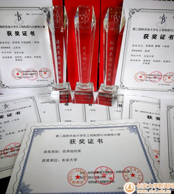
长安大学在陕西省工程制图及3D建模大赛上再获佳绩(图)
长安大学 陕西省 工程制图 3D建模大赛
2019/5/30
2019年5月24至26日,由陕西省教育厅高教处主办,西北工业大学承办的陕西省第二届工程制图及3D建模大赛在西北工业大学友谊校区举行。我校15人代表队取得了建筑类获团体一等奖、机械类获团体二等奖以及各类单项奖若干项的“大满贯”优异成绩。我校被授予优秀组织奖。竞赛设机械类、建筑类两个类别,涉及尺规绘图、三维建模两个单项,分设团体、单项(尺规作图、建模)一、二、三等奖。来自全省包括全部985及211重...
A REVIEW OF 3D GIS FOR USE IN CREATING VIRTUAL HISTORIC DUBLIN
Historic City Modelling GIS HBIM Laser Scanning
2019/3/1
This paper illustrates how BIM integration with GIS is approached as part of the workflow in creating Virtual Historic Dublin. A design for a WEB based interactive 3D model of historic buildings and c...
EXTENDING INDOOR OPEN STREET MAPPING ENVIRONMENTS TO NAVIGABLE 3D CITYGML BUILDING MODELS: EMERGENCY RESPONSE ASSESSMENT
Emergency evacuation responses Digital data management
2018/11/9
Disaster scenarios in high-rise buildings such as the Address Downtown, Dubai or Grenfell Tower, London have showed ones again the importance of data information availability for emergency management ...
THE URBAN HERITAGE CHARACTERIZATION USING 3D GEOGRAPHIC INFORMATION SYSTEMS. THE SYSTEM OF MEDIUM-SIZED CITIES IN ANDALUSIA
Cultural Heritage Intermediate Cities Urban and Territorial Studies Urban Parameters
2018/11/9
The primary objective of this paper is to approach the use of the 3D Geographic Information Systems (3D GIS), as an instrumental tool that allows us to deal efficiently with the extensive amount of in...
A USABILITY EVALUATION OF A 3D MAP DISPLAY FOR PEDESTRIAN NAVIGATION
Pedestrian Navigation LOD 3D 2D Usability
2018/11/9
This paper is focused to address the map display usability for finding given POI addresses in a popular urban city area. LOD 1 of 3D representations of city buildings are presented into a 2.5D map for...
SYNERGISTIC EXPLOITATION OF GEOINFORMATION METHODS FOR POST-EARTHQUAKE 3D MAPPING OF VRISA TRADITIONAL SETTLEMENT, LESVOS ISLAND, GREECE
Post-earthquake 3D mapping Lesvos earthquake UAV Laser Scanning SfM method
2018/4/18
The aim of this paper is to present the methodology followed and the results obtained by the synergistic exploitation of geo-information methods towards 3D mapping of the impact of the catastrophic ea...
SYNERGISTIC EXPLOITATION OF GEOINFORMATION METHODS FOR POST-EARTHQUAKE 3D MAPPING OF VRISA TRADITIONAL SETTLEMENT, LESVOS ISLAND, GREECE
Post-earthquake 3D mapping Lesvos earthquake UAV, Laser Scanning SfM method
2018/5/8
The aim of this paper is to present the methodology followed and the results obtained by the synergistic exploitation of geo-information methods towards 3D mapping of the impact of the catastrophic ea...
3D MODELS FOR ALL: LOW-COST ACQUISITION THROUGH MOBILE DEVICES IN COMPARISON WITH IMAGE BASED TECHNIQUES. POTENTIALITIES AND WEAKNESSES IN CULTURAL HERITAGE DOMAIN
Structure from Motion Image Based Modelling Mobile devices 3D Imaging Representation Techniques
2018/3/6
Nowadays, 3D digital imaging proposes effective solutions for preserving the expression of human creativity across the centuries, as well as is a great tool to guarantee global dissemination of knowle...
3D MODELLING BY LOW-COST RANGE CAMERA: SOFTWARE EVALUATION AND COMPARISON
Range camera Occipital Structure SensorTM 3D modelling software comparison
2018/3/6
The aim of this work is to present a comparison among three software applications currently available for the Occipital Structure SensorTM; all these software were developed for collecting 3D models o...
THE PHOTOGRAMMETRIC SURVEY METHODOLOGIES APPLIED TO LOW COST 3D VIRTUAL EXPLORATION IN MULTIDISCIPLINARY FIELD
3d Interaction photogrammetric survey virtual empathy virtual reality
2018/3/6
In recent years, an increase in international investment in hardware and software technology to support programs that adopt algorithms for photomodeling or data management from laser scanners signific...
3D RECONSTRUCTION WITH A COLLABORATIVE APPROACH BASED ON SMARTPHONES AND A CLOUD-BASED SERVER
smartphone 3D reconstruction low-cost collaborative SfM photogrammetry dense image matching
2018/3/6
The paper presents a collaborative image-based 3D reconstruction pipeline to perform image acquisition with a smartphone and geometric 3D reconstruction on a server during concurrent or disjoint acqui...
AN OPEN SOURCE LOW-COST AUTOMATIC SYSTEM FOR IMAGE-BASED 3D DIGITIZATION
photogrammetry turntable 3D reconstruction synchronization multi camera structured light
2018/3/6
3D digitization of heritage artefacts, reverse engineering of industrial components or rapid prototyping-driven design are key topics today. Indeed, millions of archaeological finds all over the world...
COMPARISON OF LOW COST PHOTOGRAMMETRIC SURVEY WITH TLS AND LEICA PEGASUS BACKPACK 3D MODELSS
Low Cost 3D Reconstruction Mobile Mapping UWB Backpack Photogrammetry Terrestrial Laser Scanning
2018/3/6
This paper considers Leica backpack and photogrammetric surveys of a mediaeval bastion in Padua, Italy. Furhtermore, terrestrial laser scanning (TLS) survey is considered in order to provide a state o...
PHOTOGRAMMETRIC 3D RECONSTRUCTION IN MATLAB: DEVELOPMENT OF A FREE TOOL
Photogrammetry Low Cost Matlab Structure from Motion IMU
2018/3/5
This paper presents the current state of development of a free Matlab tool for photogrammetric reconstruction developed at the University of Padova, Italy. The goal of this software is mostly educatio...
3D MOBILE MAPPING WITH A LOW COST UAV SYSTEM
imagery data Inertial Measurement Unit low cost UAV mobile mapping multi-sensor
2018/3/5
In order to accomplish the automatic mobile mapping task in a small area of interest, a low cost UAV system is proposed in this paper. Multiple sensors including a global shutter camera and an inertia...