
搜索结果: 1-15 共查到“测绘科学技术 Web”相关记录185条 . 查询时间(0.209 秒)
DEVELOPMENT OF WEB BASED HIMALAYAN GLACIER INFORMATION SYSTEM USING OPEN SOURCE
Glacier Himalaya Natural Resources OGC Information System
2018/11/8
Systematic inventory of glaciers is required for a variety of applications needed for the comprehensive development of the Himalayan region such as: a) disaster warning, b) estimation of irrigation po...
MIGRATION OF DIGITAL CARTOGRAPHY TO CITYGML; A WEB-BASED TOOL FOR SUPPORTING SIMPLE ETL PROCEDURES
CityGML GIS Extract Transform and Load ETL, Open Source
2018/11/9
Digital cartography is notably produced in all countries, in different scales and formats. Latest cartographic production aims at creating 3D objects with topological consistency and rich information ...
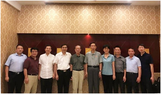
河南大学举办全国高校《Web GIS原理与技术》课程研讨会(图)
河南大学 高校 Web GIS原理与技术 课程研讨会
2018/8/13
2018年8月1日-4日,全国高校《Web GIS原理与技术》课程研讨会在我校环境与规划学院二楼报告厅举行。会议由Esri中国、高等教育出版社、河南大学联合主办,河南大学环境与规划学院承办。著名地理信息科学专家孙九林院士、王家耀院士,美国环境系统研究所(Esri)项目主管、国际华人地理信息科学协会(CPGIS)前任主席付品德教授,Esri中国区副总裁、首席咨询专家蔡晓兵高级工程师,技术专家蔡京晶高...
THE XII CENTURY TOWERS, A BENCHMARK OF THE ROME COUNTRYSIDE ALMOST CANCELLED: THE SAFEGUARD PLAN BY LOW COST UAV AND TERRESTRIAL DSM PHOTOGRAMMETRY SURVEYING AND 3D WEB GIS APPLICATIONS
XII century towers Rome Mid-Age countryside Cultural Heritage preservation close-range photogrammetry UAV photogrammetry integrated survey low-cost action camera GPS Web GIS 2D and 3D
2018/3/5
This is the consequence of the phenomenon identified with the “Incasalamento” neologism, described in depth in the following paper, intended as the general process of expansion of the urban society in...
FROM EXCAVATIONS TO WEB: A GIS FOR ARCHAEOLOGY
Excavation GIS intra-site archaeological dig photogrammetric reconstruction stratigraphical unit documentation
2017/6/20
The study and the protection of Cultural Heritage in recent years have undergone a revolution about the search tools and the reference disciplines. The technological approach to the problem of the col...
第五届在线地图,地学处理与服务国际研讨会(5th International Workshop on Web Mapping,Geoprocessing and Services)
第五届 在线地图,地学处理与服务 国际研讨会
2017/4/26
WebMGS is an important event in the field of web-based GIS, which emphasizes a diverse range of topics related to new web-based developments of geospatial theories, technologies and solutions. The Web...
The 5th International Workshop on Web Mapping,`Geoprocessing and Services
The 5th International Workshop Web Mapping,Geoprocessing and Services
2017/3/10
WebMGS is an important event in the field of web-based GIS, which emphasizes a diverse range of topics related to new web-based developments of geospatial theories, technologies and solutions. The Web...
New implementation of OGC Web Processing Service in Python programming language.PyWPS-4 and issues we are facing with processing of large raster data using OGC WPS
OGC Web Processing Service OGC WPS PyWPS Open Source Software Free Software FOSS4G OSGeo Python Server
2016/11/24
The OGC® Web Processing Service (WPS) Interface Standard provides rules for standardizing inputs and outputs (requests and responses) for geospatial processing services, such as polygon overlay. ...
CONTEST OF WEB-BASED GEOSPATIAL APPLICATIONS FOR STUDENTS AND YOUNG SCIENTISTS
WEBCON,Web-GIS web contest promotion to young people internet-based application
2016/11/15
The Asian Association on Remote Sensing (AARS) organizes a web contest (WEBCON) of photogrammetry, remote sensing and spatial information sciences in the annual meeting of Asian Conference on Remote S...
AN ADAPTIVE WEB-BASED LEARNING ENVIRONMENT FOR THE APPLICATION OF REMOTE SENSING IN SCHOOLS
adaptive learning remote sensing education web-based learning platform remote sensing in schools
2016/11/15
Satellite images have great educational potential for teaching on environmental issues and can promote the motivation of young people to enter careers in natural science and technology. Due to the imp...
SHARING HIGH-RESOLUTION MODELS AND INFORMATION ON WEB: THE WEB MODULE OF BIM3DSG SYSTEM
BIM WEB-BIM BIM3DSG 3D models reality based modelling sharing big data WebGL
2016/11/11
BIM3DSG system is described here. It is an ad hoc designed BIM system created for Cultural Heritage applications. It proposes some solutions to solve some issues related to the use of BIM in this fiel...
3D MODELLING AND INTERACTIVE WEB-BASED VISUALIZATION OF CULTURAL HERITAGE OBJECTS
3D modelling photogrammetry 3D visualisation panoramic images integration interactive visualisation
2016/11/11
Nowadays, there are rapid developments in the fields of photogrammetry, laser scanning, computer vision and robotics, together aiming to provide highly accurate 3D data that is useful for various appl...
BORDERLESS GEOSPATIAL WEB (BOLEGWEB)
Mainstream Web Geoinformation SDI OGC resources Search Access and Use
2016/11/8
The effective access and use of geospatial information (GI) resources acquires a critical value of importance in modern knowledge based society. Standard web services defined by Open Geospatial Consor...
ATLAS BASEMAPS IN WEB 2.0 EPOCH
atlas basemaps big data innovative LBS systems applications neo-cartography ubiquitous cartography
2016/11/8
The authors have analyzed their experience of the production of various Electronic Atlases (EA) and Atlas Information Systems (AtIS) of so-called "classical type". These EA/AtIS have been implemented ...
CREATION OF A WEB MAP AND MOBILE APPLICATION BASED ON A PRINTED BOOK
GIS ArcGIS History Web Application Nazi Occupation 1938-1945 Protectorate of Bohemia and Moravia Book Conversion
2016/11/8
The project describes a process of conversion of printed books into a web map and mobile application. The goal of the project is to make spatial data in the book accessible to wide public using GIS es...